MapsGL Android - Adding a custom vector tile layer
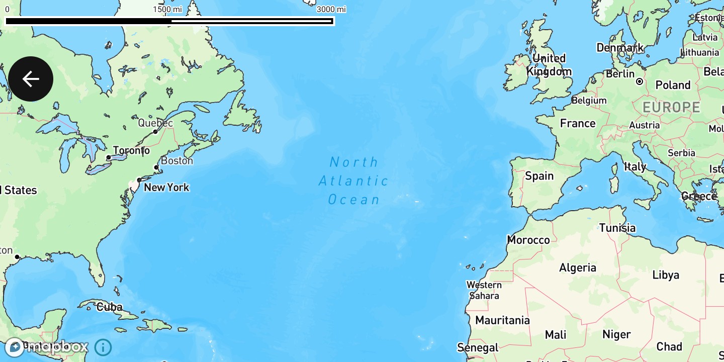
This example renders a custom vector tile layer on the map to draw water boundaries.
It is the Android port of the MapsGL JS Adding a custom vector tile layer example: one vector source for the tile endpoint, and one line layer that styles the source’s water layer. The complete activity ships in the MapsGL Android SDK demo as AddVectorLayerActivity.
The JS version pulls its tiles from Nextzen , which needs an API key of its own. This uses Xweather’s OpenStreetMap-derived vector source instead — WeatherSource.base_osm — which carries the same water source layer and authenticates with the Xweather credentials you already have, so the example runs with nothing extra to sign up for. Everything downstream of the source is unchanged, including the #333333 stroke.
Set up the map
Create a MapboxMapController, position the camera, and wait for the map to load before adding the source and layer.
import com.mapbox.maps.MapboxMap
import com.xweather.mapsgl.config.weather.account.XweatherAccount
import com.xweather.mapsgl.map.mapbox.MapboxMapController
import com.xweather.mapsgl.types.Coordinate

val xweatherAccount = XweatherAccount(
    getString(R.string.xweather_client_id),
    getString(R.string.xweather_client_secret),
)

val controller = MapboxMapController(mapView, xweatherAccount)
val mapboxMap = controller.mapboxMap ?: return

// Matches the JS example's `center: [-30.33207, 40.60621], zoom: 2`.
controller.setCenter(Coordinate(40.60621, -30.33207))
controller.setZoom(2.0)

val mapLoadedCancelable = mapboxMap.subscribeMapLoaded {
    // Add the source and layer here — see below.
}
Add the vector tile source
Vector tiles use a VectorSourceDescriptor. WeatherSource.base_osm returns one already configured with the tile URL and an authenticator, so there is no key to supply and no URL to assemble.
import com.xweather.mapsgl.sources.source.spec.VectorSourceDescriptor
import com.xweather.mapsgl.weather.WeatherSource

// Add the vector tile source.
val waterSource: VectorSourceDescriptor = WeatherSource.base_osm(controller.service)
if (!controller.hasSource(waterSource.id)) {
    controller.addSource(waterSource)
}
For a third-party endpoint you would build the descriptor yourself instead, giving it a tile URL with {z}, {x}, and {y} templates — the JS example’s Nextzen source looks like this:
import com.xweather.mapsgl.types.TileSize

VectorSourceDescriptor(
    id = "base",
    url = "https://tile.nextzen.org/tilezen/vector/v1/256/all/{z}/{x}/{y}.mvt?api_key=$nextzenKey",
    tileSize = TileSize(256),
    attribution = "© Nextzen, OpenStreetMap contributors",
)
See custom data sources for tile URL templates and credential expansion.
Style the water layer
A vector tile carries several named layers; sourceLayer selects which one to draw. The JS example’s paint.stroke fields map one-to-one onto StrokePaint.
import androidx.compose.ui.graphics.Color
import com.xweather.mapsgl.layers.spec.LineLayerDescriptor
import com.xweather.mapsgl.style.LineCap
import com.xweather.mapsgl.style.LineJoin
import com.xweather.mapsgl.style.LineLayerPaint
import com.xweather.mapsgl.style.StrokePaint
import com.xweather.mapsgl.style.StyleValue

val boundaryColor = Color(0xFF333333) // `#333333`, as in the JS example

// Style the source's `water` layer as lines.
if (!controller.hasLayer("boundaries")) {
    controller.addLayer(
        LineLayerDescriptor(
            id = "boundaries",
            source = waterSource.id,
            sourceLayer = "water",
            paint = LineLayerPaint(
                stroke = StrokePaint(
                    color = StyleValue.Constant(boundaryColor),
                    opacity = StyleValue.Constant(1.0),
                    thickness = StyleValue.Constant(2.0),
                    lineCap = StyleValue.Constant(LineCap.ROUND),
                    lineJoin = StyleValue.Constant(LineJoin.ROUND),
                ),
            ),
        ),
        beforeID = null,
    )
}
lineCap and lineJoin take the LineCap and LineJoin enums rather than the JS string literals 'round'.
Clean up
An Android activity is torn down and recreated across configuration changes, so remove the layer and then the source it references, and cancel the map-loaded subscription, in onDestroy.
override fun onDestroy() {
    if (controller.hasLayer("boundaries")) controller.removeLayer("boundaries")
    sourceId?.let { if (controller.hasSource(it)) controller.removeSource(it) }
    mapLoadedCancelable?.cancel()
    mapView.onDestroy()
    super.onDestroy()
}
Complete example
The layout is a single Mapbox MapView:
<?xml version="1.0" encoding="utf-8"?>
<androidx.constraintlayout.widget.ConstraintLayout xmlns:android="http://schemas.android.com/apk/res/android"
    xmlns:app="http://schemas.android.com/apk/res-auto"
    android:layout_width="match_parent"
    android:layout_height="match_parent">

    <com.mapbox.maps.MapView
        android:id="@+id/addVectorMapView"
        android:layout_width="match_parent"
        android:layout_height="match_parent"
        app:layout_constraintBottom_toBottomOf="parent"
        app:layout_constraintEnd_toEndOf="parent"
        app:layout_constraintStart_toStartOf="parent"
        app:layout_constraintTop_toTopOf="parent"
        app:mapbox_mapSurface="texture_view" />

</androidx.constraintlayout.widget.ConstraintLayout>
And the activity, which adds the source and layer once the map has loaded:
package com.example.mapsgldemo.docExamples

import android.os.Bundle
import android.view.ViewTreeObserver
import androidx.appcompat.app.AppCompatActivity
import androidx.compose.ui.graphics.Color
import com.example.mapsgldemo.R
import com.example.mapsgldemo.databinding.ActivityAddVectorLayerBinding
import com.mapbox.common.Cancelable
import com.mapbox.maps.MapView
import com.mapbox.maps.MapboxMap
import com.mapbox.maps.extension.style.layers.properties.generated.ProjectionName
import com.mapbox.maps.extension.style.projection.generated.projection
import com.mapbox.maps.extension.style.projection.generated.setProjection
import com.xweather.mapsgl.config.weather.account.XweatherAccount
import com.xweather.mapsgl.layers.spec.LineLayerDescriptor
import com.xweather.mapsgl.map.mapbox.MapboxMapController
import com.xweather.mapsgl.sources.source.spec.VectorSourceDescriptor
import com.xweather.mapsgl.style.LineCap
import com.xweather.mapsgl.style.LineJoin
import com.xweather.mapsgl.style.LineLayerPaint
import com.xweather.mapsgl.style.StrokePaint
import com.xweather.mapsgl.style.StyleValue
import com.xweather.mapsgl.types.Coordinate
import com.xweather.mapsgl.weather.WeatherSource

class AddVectorLayerActivity : AppCompatActivity() {

    private lateinit var binding: ActivityAddVectorLayerBinding
    private lateinit var mapView: MapView
    private var mapboxMap: MapboxMap? = null
    private lateinit var controller: MapboxMapController
    private var mapLoadedCancelable: Cancelable? = null

    /** Id of the vector source, taken from the descriptor rather than hard-coded. */
    private var sourceId: String? = null

    override fun onCreate(savedInstanceState: Bundle?) {
        super.onCreate(savedInstanceState)
        binding = ActivityAddVectorLayerBinding.inflate(layoutInflater)
        setContentView(binding.root)

        mapView = binding.addVectorMapView

        val xweatherAccount = XweatherAccount(
            getString(R.string.xweather_client_id),
            getString(R.string.xweather_client_secret),
        )

        mapView.viewTreeObserver.addOnGlobalLayoutListener(object : ViewTreeObserver.OnGlobalLayoutListener {
            override fun onGlobalLayout() {
                mapView.viewTreeObserver.removeOnGlobalLayoutListener(this)
                if (mapView.parent == null) return

                controller = MapboxMapController(mapView, xweatherAccount)
                mapboxMap = controller.mapboxMap

                // Matches the JS example's `center: [-30.33207, 40.60621], zoom: 2`.
                // Coordinate is (lat, lon), the reverse of the GeoJSON-style pair above.
                controller.setCenter(Coordinate(40.60621, -30.33207))
                controller.setZoom(2.0)

                mapLoadedCancelable = mapboxMap?.subscribeMapLoaded {
                    mapboxMap?.style?.setProjection(projection(ProjectionName.MERCATOR))

                    // Add the vector tile source. `base_osm` is Xweather's OpenStreetMap-derived
                    // vector product; the descriptor it returns already carries the tile URL and
                    // the authenticator, so no separate key is needed.
                    val waterSource: VectorSourceDescriptor =
                        WeatherSource.base_osm(controller.service)
                    sourceId = waterSource.id
                    if (!controller.hasSource(waterSource.id)) {
                        controller.addSource(waterSource)
                    }

                    // Style the source's `water` layer as lines.
                    if (!controller.hasLayer(LAYER_ID)) {
                        controller.addLayer(
                            LineLayerDescriptor(
                                id = LAYER_ID,
                                source = waterSource.id,
                                sourceLayer = SOURCE_LAYER,
                                paint = LineLayerPaint(
                                    stroke = StrokePaint(
                                        color = StyleValue.Constant(BOUNDARY_COLOR),
                                        opacity = StyleValue.Constant(1.0),
                                        thickness = StyleValue.Constant(2.0),
                                        lineCap = StyleValue.Constant(LineCap.ROUND),
                                        lineJoin = StyleValue.Constant(LineJoin.ROUND),
                                    ),
                                ),
                            ),
                            beforeID = null,
                        )
                    }
                }
            }
        })
    }

    override fun onStart() {
        super.onStart()
        mapView.onStart()
    }

    override fun onStop() {
        mapView.onStop()
        super.onStop()
    }

    override fun onLowMemory() {
        super.onLowMemory()
        mapView.onLowMemory()
    }

    override fun onDestroy() {
        if (::controller.isInitialized) {
            if (controller.hasLayer(LAYER_ID)) controller.removeLayer(LAYER_ID)
            sourceId?.let { if (controller.hasSource(it)) controller.removeSource(it) }
        }
        mapLoadedCancelable?.cancel()
        mapLoadedCancelable = null
        mapView.onDestroy()
        super.onDestroy()
    }


    companion object {
        private const val LAYER_ID = "boundaries"

        /** The layer inside the vector tile to draw — the same name Nextzen uses. */
        private const val SOURCE_LAYER = "water"

        /** `#333333`, as in the JS example. */
        private val BOUNDARY_COLOR = Color(0xFF333333)
    }
}
Related
- Custom data sources — vector tile URLs, zoom limits, and updating tile templates
- Custom map layers — all supported layer descriptors
- Data-driven styling — styling layers from feature properties