MCP Server - Tropical
Use tropical tools when tracking hurricanes, preparing situational reports, or reviewing historical analogs.
Tool Directory
| Tool | Description | Use Cases |
|---|---|---|
| xweather_get_current_active_tropical_systems | All currently active tropical cyclones worldwide with location, intensity, and movement. Answers “What storms exist now?” | Situational awareness dashboards, executive briefs. |
| xweather_get_current_tropical_storms_near_location | Active tropical systems within a chosen radius (or track/forecast proximity) of a location. Answers “Are there any hurricanes near me?” | Location-specific advisories, risk alerts, emergency planning. |
| xweather_get_tropical_cyclone_detail | Full detail for a single cyclone: lifespan, current status, historical track, and forecast track if still active. | Emergency management briefings, media updates. |
| xweather_get_historical_tropical_cyclones | Search past cyclones by basin, dates, or proximity for historical analysis and analog storm comparison. | Historical comparisons, insurance modeling. |
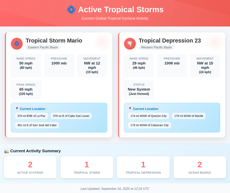
xweather_get_current_active_tropical_systems
Prompt
Are there any tropical storms and can you give me a helpful infographic?
Estimated API Calls: 1 call (global status)
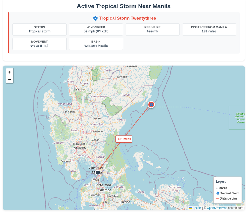
xweather_get_current_tropical_storms_near_location
Prompt
Are there any active tropical storms near Manila? If so, draw a line between the storms' current positions, and use OpenStreetMap as the base map.
Estimated API Calls: 1 call
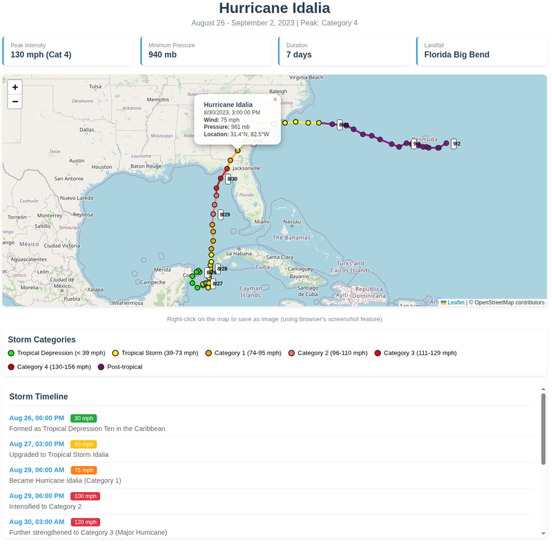
xweather_get_tropical_cyclone_detail
Prompt
Provide full details and forecast track for Hurricane Idalia.
Estimated API Calls: 1 call
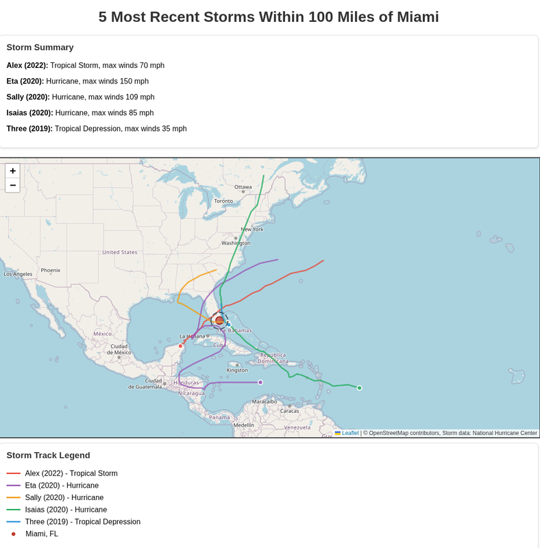
xweather_get_historical_tropical_cyclones
Prompt
Give me a map of the 5 most recent storms that came within 100 miles of Miami. Plot their tracks, and use OpenStreetMap for the base layer.
Estimated API Calls: 1 call