Extend the operational domain
)
Road friction, water, snow, and ice probabilities, and visibility forecasts beyond the vehicle's sensor range enable ADAS and AD systems to maintain availability in adverse conditions.
)
Xweather provides road conditions and atmospheric forecasts for connected and autonomous vehicle systems.
Weather shapes how vehicles and people perceive the road, how far an EV will travel, and how safely an autonomous system can operate. The cost of getting those decisions wrong is measured in accidents, degraded performance, and barriers to scaling next-generation vehicle platforms.
Xweather delivers road conditions and atmospheric data through a flexible API built for automotive use cases. From forecasts that sharpen ADAS and autonomous driving models to range-accurate weather inputs for EVs, Xweather gives carmakers and AV developers the data layer their vehicles need to adapt to changing conditions in real time.
Backed by Vaisala's nearly 90 years of weather innovation, 40 years of road weather sensor design, and over 30 years of developing accurate road weather forecasts with safety professionals, Xweather provides the world's most sophisticated road weather data. Many of the world's largest automotive brands already rely on Xweather to improve safety, efficiency, and comfort for drivers and passengers.
Real-time and predictive road conditions data extends the operational design domain beyond the vehicle's onboard sensor range.
Atmospheric and road conditions parameters for aerodynamic and rolling resistance, and thermal management modeling to improve range prediction accuracy.
Weather-aware navigation, local hazard warnings, and real-time road conditions data for in-vehicle safety and comfort experiences.
)
Discover how weather and road conditions affected EV range across the contiguous US and Europe over a full year, from March 2025 to February 2026. The 2026 report quantifies the contributions of air density, rolling resistance, road surface state, and cabin climate demand separately, providing manufacturers with the parameters they need to build accurate, weather-aware range models.
)
)
:focal(655x423:656x424))
Today's weather visualization tools suffer from a fundamental limitation: they inform without empowering. They show you data, then leave you to interpret what it means for your specific vehicle on your specific route at this specific moment.
True vehicular weather intelligence will flip this relationship by translating raw environmental data into seamless adaptations: your route dynamically re‑routes whenever the probability of ice formation on the original path rises above 70 percent, vehicle systems reconfigure within milliseconds as surface conditions deteriorate, energy‑management algorithms deliver error‑free range predictions based on how the weather will affect your specific EV and safety distances automatically adapt to match actual surface conditions.
For forward‑thinking automotive manufacturers, advanced weather intelligence is more than a safety checkbox, it’s the foundation for a reimagined driving experience that inspires range confidence by removing worries about being stranded in adverse conditions, empowers autonomous systems to keep performing even as the environment deteriorates, strengthens driver trust by detecting hazards before humans can perceive them, and continuously optimizes each journey to balance efficiency, safety, and comfort without requiring constant driver input.
At Xweather, we are already building the high-resolution road weather intelligence infrastructure that makes these scenarios possible today, not in some distant future.
The next evolution in intelligent navigation won't emerge from bolting weather features onto existing systems; it will come from treating environmental intelligence as core infrastructure within the vehicle's operational brain.
Tomorrow's vehicles won't simply display weather; they'll understand it. They'll interpret complex environmental patterns, predict how those patterns will evolve, and smoothly adapt both route and vehicle systems for optimal performance.
For automotive innovators building software-defined vehicles, the implications are clear: environmental intelligence isn't optional, it's essential architecture for creating truly intelligent mobility. The manufacturers who integrate this perspective earliest will define what driving means in the coming decade.
In the race toward vehicles that don't just transport but truly serve us, the winners won't merely see the road, they'll comprehend every molecule of it.
Xweather road weather data connects weather conditions to in-vehicle decisions. Real-time road conditions intelligence flows from sensor networks and forecasting models into production-grade APIs that automotive systems consume every 15 minutes. Historical data supports validation and scenario generation, real-time feeds enable performance testing, and the same APIs scale to deployment: one integration from R&D to production.
Road friction, water, snow, and ice probabilities, and visibility forecasts beyond the vehicle's sensor range enable ADAS and AD systems to maintain availability in adverse conditions.
)
Preemptive hazard data for friction, ice, water film, and visibility acts as a virtual sensor beyond line of sight, reducing reaction time and unexpected disengagements.
)
Predictive intelligence reduces sudden braking, system disengagements, and uncomfortable driving behavior caused by undetected surface changes.
)
Historical data for validation, real-time for testing, production APIs for deployment, all through a single integration. One provider from R&D to production.
Leading ADAS and autonomous driving developers
Onboard sensors cannot reliably detect or anticipate hazardous road and weather conditions beyond their immediate range, limiting system availability in adverse weather.
Xweather provides real-time and predictive road weather intelligence, including road friction, conditions, temperature, and visibility forecasts, extending perception beyond onboard sensors. Supports fleet management and simulation.
Higher system availability in adverse weather
Fewer disengagements through predictive hazard data
Road-specific intelligence across the full autonomy stack
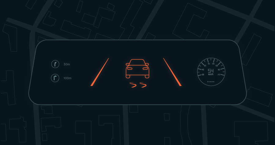
Driver warnings help automotive innovators achieve a higher Euro NCAP rating by detecting weather-dependent speed limits and displaying warnings for bad weather and slippery roads.
Since vehicle sensors cannot detect all upcoming local hazards, using external weather data can help warn drivers. The driver may need to take over the driving task if the vehicle is not permitted to operate in adverse weather conditions.
In some countries, there are conditional speed limits related to weather, among other conditions. Xweather data can detect all weather events relevant to conditional speed limits.
With Xweather data, carmakers can gain additional points in the Euro NCAP Safe Driving and Assisted Driving protocols.
BOSCH connected map services enhance both driving safety and comfort, while also increasing the availability of automated driving functions.
Enterprise-grade weather data through a globally distributed API. Real-time observations, forecasts, road weather conditions, air quality, severe weather alerts, and more, delivered with the reliability automotive systems require.
Real-time and forecast road surface conditions including friction, temperature, water film, snow depth, and ice state. Covers millions of kilometers across North America, Europe, Japan, South Korea, Australia, and New Zealand.
Dedicated atmospheric and road surface parameters for modeling the weather impact on EV range. Accounts for air drag, rolling resistance, and cabin climate demand. Available as real-time and forecast data via API.
High-resolution weather visualization built for integration into automotive dashboards, navigation systems, and developer environments. Fully customizable layers and branding for road weather, precipitation, wind, and air quality.
Real-time, location-specific hazard warnings for road friction, visibility, high winds, and other conditions that affect driving safety. Formatted for in-vehicle display and aligned with Euro NCAP requirements.
Real-time and forecast air quality data covering pollutants, pollen, and AQI at location level. Updated hourly with a 72-hour forecast for in-vehicle cabin management, route selection, and driver health applications.
From automated driving validation to production-grade EV range data, Xweather delivers the weather intelligence the automotive industry requires.
)
)