Challenge: Manual methods make data collection time-consuming
A few years ago, Lewis County identified a need to streamline its road condition survey methods and create a preventative road maintenance program. To do so, it searched for an alternative to manual surveys to save time. As a result, Lewis County replaced its manual road survey methods with RoadAI.
Previously, they had a complete list of its roads – but only the lengths and widths, not the road conditions. It conducted road condition assessments manually by taking notes of every defect with a pen and paper while driving down the roads. The process was not only stressful, but time-consuming. It took numerous weeks to survey all the roads in the network, which meant it could only do it once per year, while the goal was to do it every spring and fall. In addition, Lewis County was not able to focus on routine preventative maintenance and chip-sealing. Minor cracking could turn into a significant problem within a couple of years.
Solution: Quick and efficient road network surveys using RoadAI
To manage its road network and create a preventative maintenance program, Lewis County used RoadAI to streamline its methods of collecting road conditions.
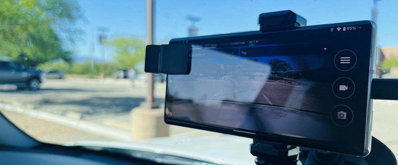
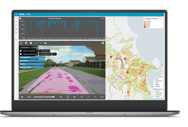
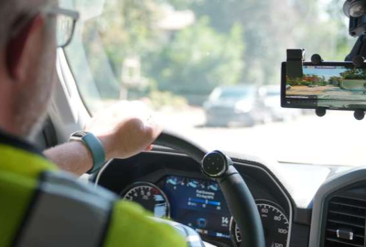
RoadAI is an app that runs on a smartphone. It is fitted into a vehicle to collect HD video. After setting up the phone, users simply drive around your road network to collect footage of road conditions and roadside assets. The footage then automatically uploads into RoadAI’s servers and is then processed withcomputer vision technology. It identifies the pavement conditions using the same methodology as the Pavement Condition Index (PCI) or Pavement Surface Evaluation and Rating (PASER) process.
Lewis County can now view a heat map of road conditions or export an Excel/Shapefile/GEOJSON file to generate maintenance plans in the same way one would use any other road condition data.
"I really don't have the time to make notes on every defect that you'd see as you're going down the road, so this product really was kind of revolutionary for me. It's very quick and efficient, and it's been very effective."
Benefits: Cost-saving preventative maintenance and valuable video footage
With RoadAI, it only takes Lewis County a day and a half to survey the entire 250-mile network. This has allowed it to conduct accurate and actionable road condition surveys twice a year. In addition, Lewis County can extend the life of its roads with routine preventative maintenance. By surveying its roads more frequently, it can intervene earlier, which allows it to budget more effectively. For example, it can identify defects before the roads fail by performing chip sealing, which costs one-tenth of the price of repaving and extends the life of their roads by six years.
"Probably the biggest thing that it's [RoadAI] helped me with is to be able to show legislators, my employees, members of the public - if they choose - a rational plan for maintaining the highways. And that data has been invaluable.”
When it comes to reactive maintenance, RoadAI has been effective at detecting roadside assets. Also, geolocated annotations have made it easy to drop a pin on road issues, such as hazardous trees and vegetation, so maintenance personnel know exactly where to go for repairs. The RoadAI footage has been used to locate standing water and drainage problems. Overall, Lewis County has been able to actively address immediate road issues, reducing potential accidents and increasing road safety.
RoadAI’s asset inventory can also be used as evidence in legal cases and disputes. For example, when Lewis County was faced with a lawsuit over a road sign, it was able to pull visual evidence of the sign at a specific date as evidence in its favor. Lewis County also started to document road damage caused by individuals, providing visual proof of the damage and helping resolve any disputes over liability. Finally, the inventory has been helpful in tracking windmill contractor activity, ensuring that the contractors are meeting their obligation to pay for any damage to the roads. These benefits demonstrate the utility of RoadAI's software in not only the management of road assets, but also as a database of video footage.
"RoadAI allows me to say, 'I’m not going to spend the money on that road because it doesn't need it, but this road does.' So now we're targeting those dollars more specifically toward the exact need.
One more significant benefit with RoadAI is that Lewis County can use the system to easily articulates the needs of its road network to legislators to secure funding. It can now show pictures, videos, data, and heat maps of where work is needed to justify its budget and decisions.
)