WeatherBlox - Tropical Layout
Tropical LayoutObject
aeris.wxblox.layouts.local.TropicalData Usage
/tropicalcyclones (2)
Raster Maps usage based on size of map and total layers.
Raster Maps usage based on size of map and total layers.
The Tropical layout displays a full profile view for a single tropical system. The output of the view will vary depending on whether or not the requested tropical system is active. Active tropical systems will display additional information with their Tropical layout view, such as track and satellite maps as well as their most recent position information.
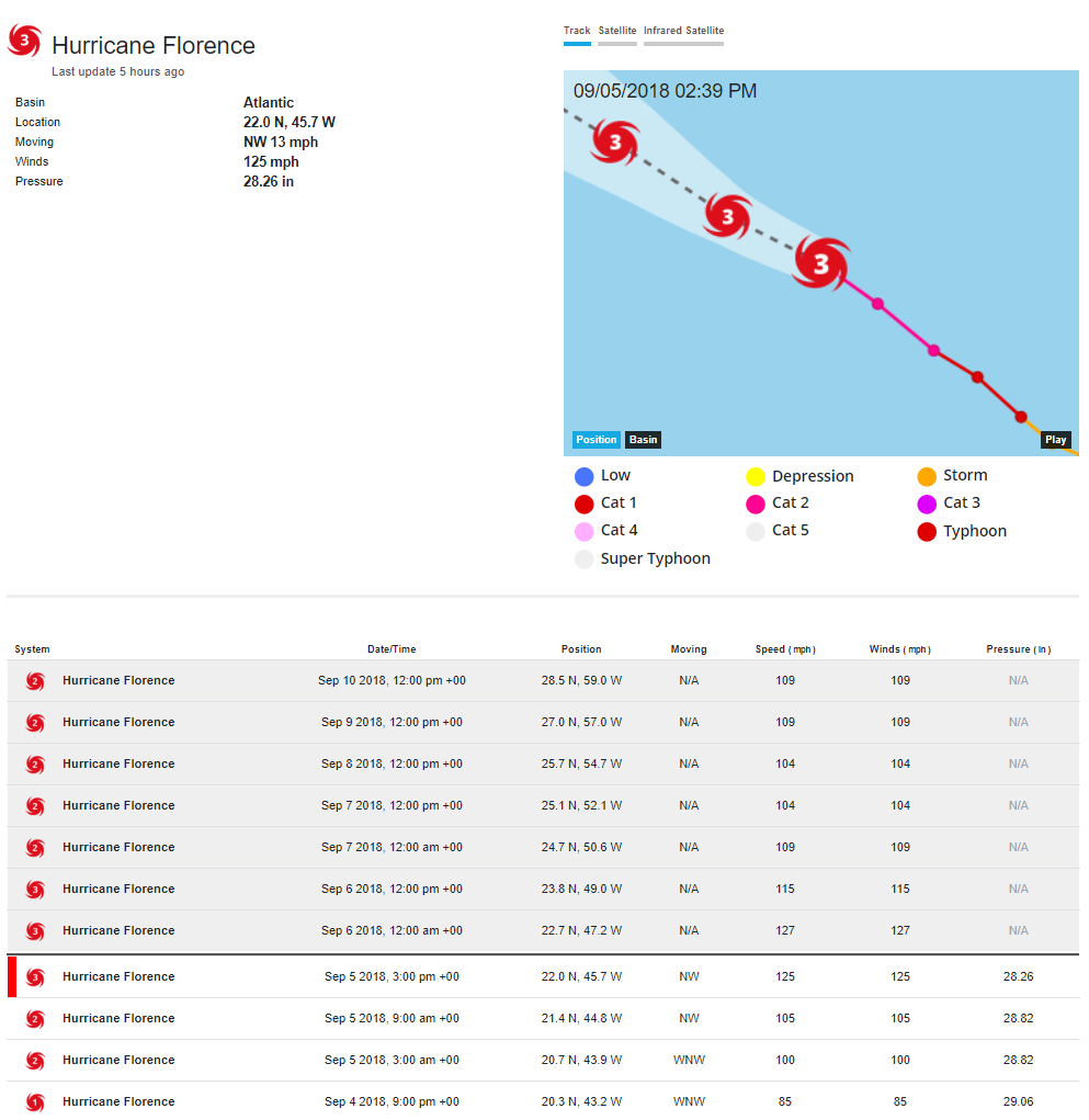
Examples
Display a full tropical system profile for Hurricane Hector from 2018:
const view = new aeris.wxblox.layouts.Tropical('#wxblox');
view.load({
    p: '2018-EP-10'
});
Configuration
The following configuration options are supported by this view:
| Option | Description | Default |
|---|---|---|
maps | Type: object () | |
track | Type: object () | |
enabled | Type: boolean () | |
metric | Type: boolean () | |
Methods
The following methods are supported by instances of this view:
rendered()show()hide()params()setUnits(:number)units()enabled()setMetric(:boolean)load(:object)refresh()isMetric()Events
The following events are triggered by instances of this view:
renderrender:beforerender:afterload:startload:doneload:errorchange:units